| Forest Area and Change | Bangladesh | Asia (excl. Middle East) | World | |
| Total forest area, 2000 (000 ha) | 1334 | 504180 | 3869455 | |
| Natural forest area, 2000 (000 ha) | 709 | 375824 | 3682722 | |
| Plantations area, 2000 (000 ha) | 625 | 110953 | 186733 | |
| Total dryland area, 1950-1981 (000 ha) {a} | 0 | 1078121 | 5059984 | |
| Change in forest area: | ||||
| Total, 1990-2000 | 14 % | -1 % | -2 % | |
| Natural, 1990-2000 | -7 % | -1 % | -4 % | |
| Plantations, 1990-2000 | 4 % | 5 % | 3 % | |
| Original forest {b} as a percent of | ||||
| total land area {c} | 100 % | X | 48 % | |
| Forest area in 2000 as a percent of | ||||
| total land area {c} | 9 % | 20 % | 29 % | |
| Forest Area by Crown Cover (000 ha), 2000 | ||||
| Note: Crown cover data are gathered using different methodologies than the forest | ||||
| area calculated above. The two estimates may differ substantially. | ||||
| Area of forest with crown cover: | ||||
| Greater than 10% | 4547 | 920164 | 6537209 | |
| Greater than 25% | 2581 | 699058 | 4842071 | |
| Greater than 50% | 1471 | 509247 | 3143720 | |
| Greater than 75% | 686 | 336266 | 1945916 | |
| Ecosystem Areas by Type | ||||
| Total land area | 14400 | 2494475 | 13328979 | |
| Percent of total land area covered by: | ||||
| Forests | 12 % | 17 % | 24 % | |
| Shrublands, savanna, and grasslands | 3 % | 37 % | 37 % | |
| mosaic | 73 % | 34 % | 20 % | |
| Urban and built-up areas | 0.2 % | 0.2 % | 0.2 % | |
| Sparse or barren vegetation; snow and ice | 0 % | 10 % | 16 % | |
| Wetlands and water bodies | 11 % | 2 % | 3 % | |
| Forests certified through the Forest Stewardship Council | ||||
| Natural forests, 2002 (hectares) | 0 | 145323 | 11457393 | |
| Plantations, 2002 (hectares) | 0 | 61936 | 3324996 | |
| Mixed forests, 2002 (hectares) | 0 | 25702 | 11461154 | |
| Forest Protection | ||||
| Percent of forests protected: | ||||
| Tropical forest, 1990s | 3.7 % | 16.4 % | 9 % | |
| Nontropical forest, 1990s | X | 5.3 % | 6 % | |
| Sparse trees and parkland, 1990s | X | 7 % | 5.5 % | |
| Number of tree species threatened, 1990s | 12 | X | 5904 | |
| Wood Production and Trade | ||||
| Annual roundwood production: | ||||
| Total, 1996-1998 (000 meters3) | 32505 | 1111958 | 3261621 | |
| Fuel, 1996-1998 (000 meters3) | 31894 | 863316 | 1739504 | |
| Industrial, 1996-1998 (000 meters3) | 610 | 268470 | 1522116 | |
| (000 meters3) | 9 | 39057 | 151390 | |
| (thousand metric tons) | 46 | 88859 | 313206 | |
| (thousand metric tons) | X | 36539 | 126404 | |
| Average value of trade in forest products {d}: | ||||
| Imports, 1996-1998 (thousand US$) | 93335 | 37114499 | 142932629 | |
| Exports, 1996-1998 (thousand US$) | 5003 | 16434017 | 135313009 | |
| Forest product exports as a percent of the | ||||
| total value of all exports, 1997 | X | 2.1 % | 2 % | |
| Other Resources: | ||||
| Country Profiles of the Food and Agriculture Organization | ||||
| Footnotes: | ||||
| a. | Areas are presented as long-term average covering the years from 1950 to 1981. | |||
| b. | Original forest refers to estimated forest cover about 8,000 years ago assuming current climatic conditions. | |||
| c. | "Forest area in 2000 as a percent of total land area" and "Original forest as a percent of total land area" are not directly comparable; data are from two different sources. | |||
| d. | Includes trade in industrial roundwood, wood fuel, sawnwood, wood-based panels, pulp, paper and paperboard, recovered paper, chips, particles, & wood residues. | |||
| View more Country Profiles on-line at http://earthtrends.wri.org | ||||
Tuesday 8 March 2011
Forests, Grasslands and Drylands COUNTRY PROFILE - Bangladesh
European Rail way
Point to Point tickets are the easiest way to save money compared to Rail passes if you only plan to travel a couple of times, from one point to another.
Point to Point Tickets, unlike a Rail Pass, are only available for one European train journey. If you plan to travel from only one point to another, once or twice, it would be better to choose Point to Point tickets than a Rail Pass.
Seat reservation is included in the total price of your ticket. If not, we’ll remind you the best value choice at the end of your booking.
Decide the specific day and time of your travel, reserve your seats: easy and cheaper!
Seat reservation is included in the total price of your ticket. If not, we’ll remind you the best value choice at the end of your booking.
Decide the specific day and time of your travel, reserve your seats: easy and cheaper!
Artesia Day Train in brief
Artesia, the high-speed premier day train, offers three daily round-trip connections between the main cities of France and Italy. Traveling at speeds of 270 km/h (180mph) you can enjoy the beautiful countryside of both France and Italy as you sit back in your comfortable seat and indulge in this relatively short and convenient train trip.
A total of 16 travel destinations are offered between the day and night Artesia trains – making it easy to combine a multi-city France – Italy excursion.
The 8-car Artesia Train can be reserved 90 days prior to the departure date.
The Artesia Day Train network
Main destinations include Paris, Torino and Milan in France and Italy.
| Journey | Travel time |
|---|---|
| Paris Gare de Lyon | 7h 36 |
| Torino Porta Susa – Milano Centrale | 1h 33 |
Our tip
DVD players and DVDs are available for rent from the club car or the snack cart.
Burj Dubai
The Burj Dubai means "Dubai Tower" in Arabic. The current projected date of completion is September 2009. The tower itself has surpassed many world records and hopes to achieve greatness both in itself, for Dubai, for the U.A.E, and ultimately for the entire Middle-East. The Burj Dubai is being developed by Emaar Properties of U.A.E, and the contractors are Samsung, Besix, Arabtec, Turner, and Emaar.
Tallest Free Standing Structure in the World
The Burj Dubai is now the tallest free standing structure in the world. It has surpassed the KVLY-TV mast which was the previously tallest structure. Since the structure is not complete, and exact figures have not been publicly released, speculation on the number of floors it will have is really unknown. Based on data gathered, we estimate that the project will be between 170 and 180 floors.

Costs
According to wikipedia, the project is budgeted at 4.1 billion dollars US. This is placed in Downtown Dubai which has a projected budget of 20 billion US to make it as competitive as possible with other world financial centers.
Inspiration
A tower's success is limited or magnified by its design. It is important that the tower is deeply rooted in the local society’s culture. That is why Adrian Smith, the architect, incorporated many patterns that are traditional in Islamic architecture into the Burj Dubai. The largest source of inspiration for the Burj Dubai was actually a flower. Adrian Smith drew inspiration from the Hymenocallis flower, which is a highly popular flower in Dubai, India, and the region. The flower's design can be seen in many of the structural elements of the design.
Purpose
The underlying purpose of the Burj Dubai is to put Dubai on the map as a spectacular city. The Sheikh Mohammad bin Rashid Al Maktoum wants to move the economy from a heavily trade based economy to that of services. Building a tower with such splendor, grander, and prestige will certainly catch the eyes of foreign investors. It also turns Dubai into a place where people want to do business.

The building will be utilized for Office, Hotel, and Residential uses. It will be in the same loop as the Dubai mall, projected to be the worlds largest mall. The Burj will contain 30,000 homes, 9 hotels, and office space.
Sales
If you are interested in calling the Burj Dubai home, then you better have your checkbook out. According to Mohamad Ali Alabbar, the CEO of Emaar Properties, the current rate for space on the Burj is $3,500 per sf. If you are interested in office space, the current going rate is $4,000 per sf
If you are interested in calling the Burj Dubai home, then you better have your checkbook out. According to Mohamad Ali Alabbar, the CEO of Emaar Properties, the current rate for space on the Burj is $3,500 per sf. If you are interested in office space, the current going rate is $4,000 per sf
Dubai Shopping Festival

Dubai is currently the hot place to shop. The Dubai Shopping Festival (DSF) that is also known as 'Layali Dubai' in Arabic was started in 1996. The main goal of Dubai shopping festival is to promote trade and tourism in Dubai. The festival annually draws about three million people to Dubai for shopping. In order to make the city as the tourist capital of the Middle East, they've made shopping largely tax free that allows merchants to import products from other countries with very few tariffs.
Dubai Shopping Festival is basically a shopping paradise. Dubai offers a blend of the modern and the traditional, mixing the best of the East with the best of the West. In Dubai shopping festival you can find anything from gold chains to Ipods at rock bottom prices. The Dubai shopping festival has succeeded in establishing itself as the leading special "shopping" event in the world. Various brands such as Visa, Pepsi and Emirates Airlines became partners to DSF's growth.During DSF several hotels and apartments also offer you special offers. Sponsored by Dubai Duty Free, the Dubai shopping festival is enlivened with international theatre and street performances, fashion shows, nightly fireworks, prize draws, children's events and laser shows. Dubai Shopping Festival offers the best brands at the world’s lowest prices.
.
PAHALGAM TOUR
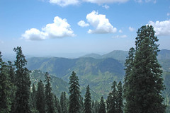
Pahalgam is proba  ly the most popular hill resort in the Kashmir valley. Since it is rather lower than Gulmarg the nighttime temperatures do not drop so low and it has the further advantage of the beautiful Lidder River running right through the town. ly the most popular hill resort in the Kashmir valley. Since it is rather lower than Gulmarg the nighttime temperatures do not drop so low and it has the further advantage of the beautiful Lidder River running right through the town.Pahalgam is situated at the junction of the Aru and Sheshnag Rivers and surrounded by soaring, fir-covered mountains with bare, snow-capped peaks rising behind them. The Aru flows down from the Kolahoi glacier beyond Lidderwat while the Sheshnag from glaciers along the great Himalayan. At the confluence of the streams flowing from the river Lidder and Sheshnag Lake, Pahalgam was once a humble shepherd's village with breathtaking views. Now it Kashmir's premier resort, cool even during the height of summer. A number of hotels and lodges cater to all preferences and budgets, from luxurious to unpretentious trekkers' lodges, including JKTDC's delightfully romantic, fully furnished huts, partially concealed by giant pine trees. Pahalgam Walks - There are many short walks available from Pahalgam and in addition it is an excellent base for longer treks such as those to the Kolahoi glacier or to the Amarnath cave. Pahalgam can also be used as a starting point for treks out of the region. Pahalgam is particularly famed for its many shepherds and they're a common sight, driving their flocks of sheep along the paths all around the town.  Mamaleshwara Mamaleshwara is only a km or so downstream from Pahalgam, and on the opposite side of the Lidder, is this small Shiva temple with its square, stone tank. It is thought to date from the reign of king Jayasima in the 12th century, even earlier. Baisaran This meadow, about 5-km from Pahalgam and 150m higher, provides excellent views over the town and the Lidder valley. Pine forests and the snowclad mountains surround the grassy glen. One can hire ponies for this trek from near the centre of town. Tulian Lake If one continues 11-km beyond Baisaran one reaches the Tulian Lake at 3,353m, 1,200m higher up. It is covered in ice for much of the year and surrounded by peaks, which rise more than 300m above its shores. It also can be reached by pony trek. Aru The little village of Aru is actually the first stage from Pahalgam on the trek to Lidderwat and the Kolahoi glacier. It makes an interesting day walk from Pahalgam, following the Lidder river for Pahalgam, following the Lidder river for 11-km upstream. The main track, which also can be taken by car, is on the left bank of the river. There is also a less used, and more difficult path, on the right bank. At Aru one will often find the Gujars, living in their log huts with their flocks of sheep and goats, en route to the higher sheep and goats, en route to the higher pastures for the summer. Hajan Hajan, on the way to Chandanwari is an idyllic spot for a picnic. Filmgoers will recognize it instantly as it has been the location of several movie scenes. Chandanwari & Passage To The Amarnath Yatra  eved to the abode of Lord Shiva. Although the road from Pahalgam to Chandanwari is on fairly flat terrain, and can be undertaken by car, from Chandanwari onwards the track becomes much steeper, being accessible on foot or by pony. eved to the abode of Lord Shiva. Although the road from Pahalgam to Chandanwari is on fairly flat terrain, and can be undertaken by car, from Chandanwari onwards the track becomes much steeper, being accessible on foot or by pony.Located 11-km from Chandanwari is the mountain lake of Sheshnag, after which 13-km away is the last stop, Panchtarni. The Amarnath cave is 6-km away from there. During the month of 'Sawan', an ice stalagmite forms a natural Shivling (also spelt as Shivlinga), which waxes and wanes with the phases of the moon. The state government makes extensive arrangements every year for the successful completion of the pilgrimage, registering each one of the over one lakh pilgrims, pony owners and Dandi Walas, providing camps en route, and ensuring safe, comfortable and speedy progress of the Yatris. Even if one's visit to Pahalgam is not during the period of the Yatra, one can still take a pony ride up to Sheshnag Lake, returning late evening. Fishing Pahalgam is one of Kashmir's popular trout fishing beats. Kashmir is famous for its trout although they tend to be rather small. Additionally, fishing licences are hard to get and rather expensive. A compulsion is to keep am guide and one is also permitted to catch six fishes, which is the daily limit. HOW TO REACH THEREAir: Pahalgam is in Anantnag District and is about 96-km from Srinagar. The nearest airport is in Badgam District. This Airport is connected with all the major cities of India. Rail: The nearest Rail Head is at Jammu and from there National Highway NH1A connects the Kashmir valley with India. Road: The road to Pahalgam can be taken to Khannabal or alternatively from Bijbehara villages from National Highway NH1A. Every sort of transport to suit every budget from Buses to Taxis ply on this Highway. It takes around 10 to 12 hours to cross this mountainous road, which crosses some beautiful spots and the famous Jawahar Tunnel linking Kashmir Valley with India. Bus service is available from Srinagar and Anantnag, which leave at fixed time from the Bus stands. Taxis and other sort of transport can be hired from Srinagar at pre-fixed rates. Assistance is available at Tourist Reception Centre, Srinagar. On Road to Pahalgam one comes across the beautiful Lidder Valley with important spots of Mattan and Aishmuqam |
| . |
SONAMARG TOUR
Sonamarg is the base of a major trek that passes along several mountain lakes –Vishansar, Kishansar, Gadsar, Satsar and Gangabal. Sonamarg is also the take off station for the drive to Ladakh across the Zojila, a major pass in the Great Himalayan Range, through which the Srinagar-Leh Road passes. The Meadow Of Gold  At a height of 2,740m, Sonamarg is the last major point in the Kashmir valley before the Zoji La pass into Ladakh . At the pass the green, lush Kashmiri landscape abruptly switches to the barren, dry landscape of Ladakh. Sonamarg is thus not only a good base for treks but also a jumping off point for trips into Ladakh. At a height of 2,740m, Sonamarg is the last major point in the Kashmir valley before the Zoji La pass into Ladakh . At the pass the green, lush Kashmiri landscape abruptly switches to the barren, dry landscape of Ladakh. Sonamarg is thus not only a good base for treks but also a jumping off point for trips into Ladakh.The name means 'Meadow of Gold' and although this could be due to the profusion of flowers that carpet the meadow in the spring it is also possible that the name derives from Sonamarg's strategic trading position in the days when this was a major route into central Asia. The Sindh River meanders along here and abounds with Trout and Mahseer. Walks From Sonamarg  Oneof the most popular short walks from Sonamarg and a major attraction during the summer months is the 4-km route to Thajiwas, a small valley at the foot of the Sonamarg glacier. A path leads up to the Shakhdar hill, overlooking the glacier from the northeast. It is dangerous to climb the steep slope leading up to the glacier. Ponies can be hired for the trip up to Thajiwas glacier. Often in early summer one will meet groups of Gujar passing through Sonamarg on their way to the alpine meadows for the summer. Oneof the most popular short walks from Sonamarg and a major attraction during the summer months is the 4-km route to Thajiwas, a small valley at the foot of the Sonamarg glacier. A path leads up to the Shakhdar hill, overlooking the glacier from the northeast. It is dangerous to climb the steep slope leading up to the glacier. Ponies can be hired for the trip up to Thajiwas glacier. Often in early summer one will meet groups of Gujar passing through Sonamarg on their way to the alpine meadows for the summer.Nilagrad A mountain river meets the Indus at the Baltic colony, Nilagrad, 6-km away from Sonamarg. The water of the river is reddish in colour. The Baltic thinks the water has curative power of many diseases. Inhabitants of the colony visit this place every Sunday to bath in the river. Bisansar Lake & Krishnasar Lake There is a lake in every corner of the Himalayas and there is one at Sonamarg also. The road proceeds from Sonamarg to Bisansar Lake via Nichinai Pass. Crossing the river at Nichinai Pass stands the Bisansar Lake at an altitude of 4, 084m, with its its lovely natural beauty. Beside the lake is the Krishnasagar Lake at an altitude of 3,801m, popular for Trout fishing. Baltal This beautiful meadow is right at the foot of the Zoji La pass and thus is the final place in Kashmir. The river from the foot of the Amarnath glacier meets the Indus near Baltal. It stands at a height of 2,743m and during the Amarnath pilgrimage there are tents set up here. It is possible to walk to the Amarnath cave, more usually approached from Pahalgam, in one day. Check about conditions before departing, though. The weather can be treacherous and at other times melting snow and ice make the route very dangerous. There's now a jeep road most of the way to the cave. The turn off to Baltal is at 94-km on the Leh road, and then it's 3-km or so downhill. Yushmarg If one can take some time out, then take tour of Yushmarg in daytime. Buses on conducted tours run to Yushmarg thrice a week. 47-km southwest of Srinagar amidst pines and firs lies the vale - Yushmarg (2,700m) at the slope of the Pir Panjal ranges. Its is a beautiful pasture as well as a nice picnic spot. HOW TO REACH THEREAir: Sonamarg is in Srinagar District on the Srinagar Leh Highway, 81-km from Srinagar. The nearest airport is in Badgam District, connecting the capital city with all the major cities in India. Rail: The nearest Railhead is at Jammu and from there National Highway NH1A connects the Kashmir valley with India. Road: Every sort of transport to suit every budget from Buses to Taxis ply on National Highway NH1A. It takes around 10 to 12 hours to cross this mountainous road, which crosses some beautiful spots and the famous Jawahar Tunnel linking Kashmir Valley with India. Bus service is available from Srinagar and Anantnag, which leave at fixed time from the Bus stands. Taxis and other sort of transport can be hired from Srinagar at pre-fixed rates. Assistance is available at Tourist Reception Centre, Srinagar |
| . |
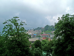
SRINAGAR TOUR
Srinagar is located in the heart of the Kashmir valley at an altitude of 1,730 m above sea level, spread on both sides of the river Jhelum. The Dal and Nagin lakes enhance its picturesque setting, while the changing play of the seasons and the salubrious climate ensures that the city is equally attractive to visitors around the year. Kalhana, the author of 'Rajtarangini’, states that Srinagri was founded by Emperor Ashoka (3rd Century BC). The presen  t city of Srinagar was founded by Pravarasena-II, and Hiuen Tsang, who visited Kashmir in 631 AD, found it at the same site as it is today. Laltaditya Muktapida was the most illustrious ruler of Kashmir in the Hindu period, which ended in 1339 AD. King Zain-ul-Abidin (1420-70 AD), popularly known as‘Budshah’, was a great patron of Sanskrit. Akbar captured Kashmir valley for the Mughals, who endowed Srinagar with beautiful mosques and gardens. The Sikhs overthrew the last Muslim ruler in the reign of Maharaja Ranjit Singh in 1819. In 1846 the Dogras secured the sovereignty of Kashmir from the British under the Treaty of Amrjtsar, and in 1947 the state of Jammu and Kashmir with Srinagar as its capital, became part of the Indian Union. t city of Srinagar was founded by Pravarasena-II, and Hiuen Tsang, who visited Kashmir in 631 AD, found it at the same site as it is today. Laltaditya Muktapida was the most illustrious ruler of Kashmir in the Hindu period, which ended in 1339 AD. King Zain-ul-Abidin (1420-70 AD), popularly known as‘Budshah’, was a great patron of Sanskrit. Akbar captured Kashmir valley for the Mughals, who endowed Srinagar with beautiful mosques and gardens. The Sikhs overthrew the last Muslim ruler in the reign of Maharaja Ranjit Singh in 1819. In 1846 the Dogras secured the sovereignty of Kashmir from the British under the Treaty of Amrjtsar, and in 1947 the state of Jammu and Kashmir with Srinagar as its capital, became part of the Indian Union.Houseboats If one is longing for the delights of a houseboat holiday, then check out lakes of Srinagar to try one. Srinagar is a unique city because of its lakes - the Dal , Nagin and Anchar. The River Jhelum also flows through a part of the city.  Most houseboats on the Nagin and the Jhelum are situated on the banks of the lake, and can be accessed directly from land without the help of a Shikara. While all those on the Dal require a Shikara to get to and from them. Most houseboats on the Dal are situated in long straggling rows; some face the boulevard, Srinagar's exciting address, while others are situated singly or in groups of two and three. City Of Lakes Srinagar's lakes are the reason why the city receives so many tourists. Not just expanse of water, the lakes are filled with houseboats, villages, narrow water canals, lotus and vegetable gardens and houses and shops. Life on the lakes, as witnessed from the confines of a Shikara, is unique. It is possible to book a Shikara for the whole day and sightsee Nishat Garden, Nasim Bagh, Hazratbal Mosque, Pathar Masjid and Shah Hamdan's Shrine, having a picnic lunch in the boat. DAL LAKE The Dal is famous not only for its beauty, but for its vibrance, because it sustains within its periphery, a life that is unique anywhere in the world. The houseboat and Shikara communities have lived for centuries on the Dal, and so complete is their infrastructure on the lake, that they never have to step on land! Doctors, tailors, bakers- one can see them all in tiny wooden shops on the lake, near picturesque vegetable gardens and acres of lotus gardens  The most confusing parts of Srinagar for it's not really one lake at all, but three. Further more much of it is hardly what one would expect a lake to be like - it's a maze of intricate waterways and channels, floating islands of vegetation, houseboats that look so firmly moored they could almost be islands and hotels on islands which look like they could simply float away. NAGIN LAKE Nagin is generally held to be the most beautiful of the Dal lakes. Its name comes from the many trees, which encircle the small, deep blue lake. Nagin is only separated from the Larer Dal lakes by a narrow causeway and it also has a number of houseboats moored around its perimeter.  Nagin Lake, which is usually thought of as a separate lake, is also divided from Dal Lake only by a causeway. The causeways are mostly suitable for walkers and bicycles only so they make a very pleasant way of seeing the lake without having to worry about traffic or Shikaras. A Nice Getaway If one wats to really get away from the chaotic city life all then Nagin is a good place to find a house boat and do it the surroundings are much more serene and isolated than on Dal Lake. One can rent rowboats from the camping site here - either to simply row around the lake or to look around for a houseboat. MUGHAL GARDENS  Kashmir was a favourite of the Mughal emperors who visited it as often as they could. Cool and refreshing after the plains of North India where the business of governance kept them, they planted gardens with stepped terraces and flowing watercourses. When they rested in their gardens, they dreamt they were in paradise. Kashmir was a favourite of the Mughal emperors who visited it as often as they could. Cool and refreshing after the plains of North India where the business of governance kept them, they planted gardens with stepped terraces and flowing watercourses. When they rested in their gardens, they dreamt they were in paradise.The next garden along the road that encircles the Dal is the Nishat, built by empress Nur Jahan's brother Asaf Khan. The largest of the gardens, Nishat has several terraces, a central watercourse and a majestic site between the Dal and the Zabarwan hills. The third Mughal garden - the Shalimar - was planted by Jehangir, the Mughal emperor, whose love for Kashmir was legendary. Shaded by magnificent Chinar trees, the Shalimar is a series of stone pavilions and flowing water with paint box bright flowerbeds. SHALIMAR BAGH T  he Shalimar were built by Emperor Jehangir for his wife Nur Jahan, 'light of the world' in 1616. Although it is known today as the 'garden of love' it was originally named the Farah Bakhsh or 'delightful garden'. he Shalimar were built by Emperor Jehangir for his wife Nur Jahan, 'light of the world' in 1616. Although it is known today as the 'garden of love' it was originally named the Farah Bakhsh or 'delightful garden'.The garden is built in four terraces with traditional water channel running down the middle. The gardens measure 540 by 183 metres. During the Mughal period the top terraces used be reserved for the emperor and the ladies of the court and was the most magnificent. It included a pavilion made of black stone in the middle of the tank. Black Marble fluted pillars supported the pavilion, which was used as a banquet hall. Shalimar Bagh has an air of seclusion and repose, and its rows of fountains and shaded trees seem to recede towards the snowcapped mountains. A Son Et Lumeiere or sound and light show is put on here every evening during the May to October tourist season. PARIMAHAL The old Sufi college of Pari Mahal, the 'palace of the fairies', is only a short distance above the Chasma Shahi gardens. One can easily walk from the gardens up to the Pari Mahal then follow a footpath directly down the hill to the road that runs by the Oberoi Palace Hotel. The Pari Mahal consists of a series of arched terraces. Recently it has been turned into a very pleasant and well-kept garden with fine views over Dal Lake. It's attractively sited on a spur of the Zabarwan Mountains. The gardens are beautifully kept even today and a Son Et Lumiere show is put on here every evening during the May to October tourist season. NISHAT BAGH The Nishat Bagh is another lovely garden with its 12 terraces representing the 12 signs of the zodiac, which descend gradually and seem to almost merge into the lake. It is situated on the banks of world famous Dal Lake in the backdrop of Zabarwan hills. With its flowerbeds, trees, fountains, the Nishat presents a dramatic sight. The gardens were designed in 1633 by Asaf Khan, brother of Nur Jahan, and follow the same pattern as the Shalimar gardens with a polished stone channel running down the centre and a series of terraces. It's the largest of the Mughal gardens measuring 548 metres by 338 metres, and often the most crowed. The walks beside the channel are bordered with lines of cypresses and Chinars. Also found within its vicinity are some remains of Mughal period buildings including a double storey pavilion enclosed on two sides latticed windows. Directly behind the garden is the Gopi Tirth, a small spring gushing forth crystal clear water, which feeds the garden water. CHASMA SHAHI Cheshma Shahi is the first Mughal garden one will pass after Nehru Park. Built at a height above the city, its views are as stupendous as its layout. The smallest of Srinagar's Mughal gardens, Cheshma Shahi has only three terraces in addition to a natural spring of water enclosed in a stone pavilion. Smallest of the Srinagar Mughal gardens, measuring just 108 metres by 38 metres, the Chasma Shahi, or 'Royal Spring', are well up the hillside, above the Nehru Memorial Park. The fresh water spring in these pleasant, quieter gardens is reputed to have medicinal properties. The gardens were laid out in 1632 by Ali Mardan Khan and include three terraces, an aqueduct, waterfalls and fountains. The water from the spring supplies the fountains and then goes through the floor of the pavilion and falls to the lower terrace in a fine cascade of five metres, over a polished black stone chute. Some extensions have recently been made to the gardens. Like all the gardens the Chasma Shahi is open from sunrise to sunset but unlike the other gardens this is the only one, which charges admission. There is a small shrine, the Chasma Sahibi, near the gardens, which also has a fresh water spring |
| . |
Murree
(ArticlesBase SC #3703646)
Submit articles to Articlesbase.com, and watch your traffic increase. Click here to make it happen.Liked this article? Click here to publish it on your website or blog, it's free and easy!Read more: http://www.articlesbase.com/destinations-articles/murree-travel-guide-best-tourist-spot-in-pakistan-3703646.html#ixzz3WsC1aKS6
Under Creative Commons License: Attribution
New Travelling Technology
Technology

Many people see technology as a solution to some of the problems that exist on our planet. It’s true that technology can be used for good, but with new developments come new challenges issues. The digital divide is one such issue, one that people are actively trying to overcome. Telecentres aim to bridge the digital divide by providing people access and knowledge about information technologies. A global telecentre movement is growing right now. Unfortunately, even where computer facilities are readily available, the digital divide persists—even in the world's most wealthy countries, access to the latest and most beneficial technologies is limited for those in rural areas and people with disabilities.
There are many other issues to consider when talking about ICTs and their role in our lives, beyond the digital divide and universal accessibility. The internet has created new and innovative ways for people to shape and share their identity, and express themselves. However, to some people, the internet can appear to be a modern day “wild west,” or something to fear. The rise of online social networking, shopping, and other online interactions that ask people to share a large amount of personal information have led to a number of risks that every internet user needs to bear in mind.
The internet may looked uncontrolled; however, telecommunication companies and governments around the world own the infrastructure behind the internet, and different governments and companies are asserting that ownership in different ways. No sole entity controls the internet, which is making the concept of internet governance or the uniform application of rules a very complicated issue.
However, these are not the only observations to be made. Recently, many advances in mobile media and technology have been made, creating a new world of possibilities. Our challenge is to figure out how to use technology - both the existing and the emerging - for good, and how to assure its access and use in the most democratic way possible.
Media

Our need to express and create is powerful. It provokes experimentation and inspires artistic cultural expressions such as visual art, dance, writing, theatre, and music. These cultural expressions are taking on a new shape and meaning in contemporary society.
One form of media that has become increasingly popular in today’s society is mass media (mainstream media). It consists of radio, television, magazines, newspapers, and of course, the Internet. Mass media’s primary objective and purpose is to inform, educate and entertain the largest possible audience. An important facet of mass media is its ownership and consumer-based motives.
On a daily basis we are bombarded with messages and advertising, but we are able to think critically and analyze them based on how money, values, political influence, and corporate ownership affect the content within. When we do this, we are practicing media literacy: the ability to separate fact from fiction as well as understand the nature of media.
Issues of representation must also be considered in a media analysis. Are diverse people and viewpoints represented? Do we see varied representations of class, ethnicity, gender, sexuality, social role and occupation, or only stereotypes? It is easy to see how the dominant Western culture in our society sways and influences every decision relating to mass media and how little minorities have a say in what goes on in the communications industry.
Beyond simply receiving, we too can create the messages. Independent media is thriving on the Internet and young activists are behind the surge of empowered citizen-driven communication.
This section contains pages on independent and mass media, intellectual property, censorship, television and film, advertising, writing and publishing. We invite you to understand how arts and media affect our lives and how we as consumers, are becoming more imaginative, creative and media literate.

The greatest challenge that the human race has ever faced still remains: to live in a world free of the threat of violence. Violence is not restricted to times of war; it exists everywhere: in homes, schools and communities. Where there is injustice, there is conflict.
Some argue that much of the conflict in world can be attributed to the existence of an oppressive social system of power that reinforces differences between groups and allows one group to have power or privilege over another group. Conflict at the local and international level can stem from exploitation, poverty, corrupt governance, resource scarcity, and dehumanizing beliefs. One popular theory states that as long as the global system relies on exploitive, oppressive and hierarchical relationships, there will likely exist conflict. Another prevailing conflict theory says that conflict is inherent and constant, but when positively managed it can be a productive force.
On a local level, many grassroots organizations work directly with their communities to counter conflict with prevention strategies through educational campaigns as well as support services for those recovering from violence. Whether individually or in a group, we as global citizens have a responsibility to promote a culture of peace, and resolve differences without resorting to conflict. Topics explored in greater detail in this section are: Youth violence, Arms Control, war children, and genocide.
To learn more about the Global Issues’ Guide-to-Action model used for this issue click:
"http://www.tigweb.org/understand/issues/ "
APOLOGIES AND REPARATIONS PERSPECTIVE
Over the past few centuries the world has seen their share of human atrocities from the mass colonization and destruction of the majority of the world’s cultures and peoples, particularly that of Indigenous peoples and their lands, to the more than 300 year-long transatlantic slave trade that has systematically devastated the lives of several generations of people worldwide. So how can we redress these wrongs of the past? One way people have been addressing atrocities of the past is through the use of apologies and reparations. An apology, in this case, is a statement of regret that publicly acknowledges the occurrence and severity of the act of injustice committed; and reparations refers to a practical action that has been taken, such as paying money to the victims, to remedy the wrong that has been done. Both apologies and reparations seek to repair a relationship that has been compromised by some purposeful offense. However, apologies can only symbolically address wrongs that have been committed, while reparations are more tangible representations of the offenders willingness to begin repairing the relationship between offender and offended.
There has been much controversy over the issue of apologies and reparations in many parts of the world where some have questioned the practicality of apologizing and offering reparations to a person or group of people who have been unduly harmed given the fact that these actions are unable to reverse the wrongs that have already been done. In response, some advocates of apologies and reparations put forth that although the victims of offenses warranting an apology and reparations often suffer great degrees of loss in terms of dignity, rights, property, wealth, justice, and their overall well-being, apologies and reparations are meant to signal efforts towards peace and reconciliation that may have otherwise been ignored.
Have something more to add to what we’ve discussed above, then check out this global issue’s wiki page to have your say!
Many people see technology as a solution to some of the problems that exist on our planet. It’s true that technology can be used for good, but with new developments come new challenges issues. The digital divide is one such issue, one that people are actively trying to overcome. Telecentres aim to bridge the digital divide by providing people access and knowledge about information technologies. A global telecentre movement is growing right now. Unfortunately, even where computer facilities are readily available, the digital divide persists—even in the world's most wealthy countries, access to the latest and most beneficial technologies is limited for those in rural areas and people with disabilities.
There are many other issues to consider when talking about ICTs and their role in our lives, beyond the digital divide and universal accessibility. The internet has created new and innovative ways for people to shape and share their identity, and express themselves. However, to some people, the internet can appear to be a modern day “wild west,” or something to fear. The rise of online social networking, shopping, and other online interactions that ask people to share a large amount of personal information have led to a number of risks that every internet user needs to bear in mind.
The internet may looked uncontrolled; however, telecommunication companies and governments around the world own the infrastructure behind the internet, and different governments and companies are asserting that ownership in different ways. No sole entity controls the internet, which is making the concept of internet governance or the uniform application of rules a very complicated issue.
However, these are not the only observations to be made. Recently, many advances in mobile media and technology have been made, creating a new world of possibilities. Our challenge is to figure out how to use technology - both the existing and the emerging - for good, and how to assure its access and use in the most democratic way possible.
Media
Our need to express and create is powerful. It provokes experimentation and inspires artistic cultural expressions such as visual art, dance, writing, theatre, and music. These cultural expressions are taking on a new shape and meaning in contemporary society.
One form of media that has become increasingly popular in today’s society is mass media (mainstream media). It consists of radio, television, magazines, newspapers, and of course, the Internet. Mass media’s primary objective and purpose is to inform, educate and entertain the largest possible audience. An important facet of mass media is its ownership and consumer-based motives.
On a daily basis we are bombarded with messages and advertising, but we are able to think critically and analyze them based on how money, values, political influence, and corporate ownership affect the content within. When we do this, we are practicing media literacy: the ability to separate fact from fiction as well as understand the nature of media.
Issues of representation must also be considered in a media analysis. Are diverse people and viewpoints represented? Do we see varied representations of class, ethnicity, gender, sexuality, social role and occupation, or only stereotypes? It is easy to see how the dominant Western culture in our society sways and influences every decision relating to mass media and how little minorities have a say in what goes on in the communications industry.
Beyond simply receiving, we too can create the messages. Independent media is thriving on the Internet and young activists are behind the surge of empowered citizen-driven communication.
This section contains pages on independent and mass media, intellectual property, censorship, television and film, advertising, writing and publishing. We invite you to understand how arts and media affect our lives and how we as consumers, are becoming more imaginative, creative and media literate.
Identify & Get Informed
The greatest challenge that the human race has ever faced still remains: to live in a world free of the threat of violence. Violence is not restricted to times of war; it exists everywhere: in homes, schools and communities. Where there is injustice, there is conflict.
Some argue that much of the conflict in world can be attributed to the existence of an oppressive social system of power that reinforces differences between groups and allows one group to have power or privilege over another group. Conflict at the local and international level can stem from exploitation, poverty, corrupt governance, resource scarcity, and dehumanizing beliefs. One popular theory states that as long as the global system relies on exploitive, oppressive and hierarchical relationships, there will likely exist conflict. Another prevailing conflict theory says that conflict is inherent and constant, but when positively managed it can be a productive force.
On a local level, many grassroots organizations work directly with their communities to counter conflict with prevention strategies through educational campaigns as well as support services for those recovering from violence. Whether individually or in a group, we as global citizens have a responsibility to promote a culture of peace, and resolve differences without resorting to conflict. Topics explored in greater detail in this section are: Youth violence, Arms Control, war children, and genocide.
To learn more about the Global Issues’ Guide-to-Action model used for this issue click:
"http://www.tigweb.org/understand/issues/ "
APOLOGIES AND REPARATIONS PERSPECTIVE
Over the past few centuries the world has seen their share of human atrocities from the mass colonization and destruction of the majority of the world’s cultures and peoples, particularly that of Indigenous peoples and their lands, to the more than 300 year-long transatlantic slave trade that has systematically devastated the lives of several generations of people worldwide. So how can we redress these wrongs of the past? One way people have been addressing atrocities of the past is through the use of apologies and reparations. An apology, in this case, is a statement of regret that publicly acknowledges the occurrence and severity of the act of injustice committed; and reparations refers to a practical action that has been taken, such as paying money to the victims, to remedy the wrong that has been done. Both apologies and reparations seek to repair a relationship that has been compromised by some purposeful offense. However, apologies can only symbolically address wrongs that have been committed, while reparations are more tangible representations of the offenders willingness to begin repairing the relationship between offender and offended.
There has been much controversy over the issue of apologies and reparations in many parts of the world where some have questioned the practicality of apologizing and offering reparations to a person or group of people who have been unduly harmed given the fact that these actions are unable to reverse the wrongs that have already been done. In response, some advocates of apologies and reparations put forth that although the victims of offenses warranting an apology and reparations often suffer great degrees of loss in terms of dignity, rights, property, wealth, justice, and their overall well-being, apologies and reparations are meant to signal efforts towards peace and reconciliation that may have otherwise been ignored.
Have something more to add to what we’ve discussed above, then check out this global issue’s wiki page to have your say!
Travel technology: the best apps and eReaders
Your Reality, Augmented

Imagine if your phone could use GPS information and a compass to lead you to the nearest restaurant or cash machine. In fact, it already can: welcome to "augmented reality", or AR, a technology that overlays digital information on a real-world view, typically using your mobile phone's camera and screen.
"Point your phone at a building and see its history or look at a painting and see the Grove Dictionary article on it. In 2010, this revolution in travel information is just beginning," says James Governor, an industry analyst with Redmonk.
Mobile phone AR apps Layar (www.layar.eu) and Wikitude World Browser (www.wikitude.org) are already out there, serving up travel information from the likes of Spotted by Locals (www.spottedbylocals.com), Yelp! (www.yelp.co.uk) and social game Noticings (www.noticin.gs)
Lastminute.com was among the first travel companies to experiment with the technology. "We think AR will take a significant chunk of the market in time," says Marko Balabanovic at Lastminute.com. "What we've seen so far are the primitive beginnings, and there will be massive improvements over the next two years. Our goal, with apps such as Nru and Snaffle, is to enable "n-commerce", where "n" stands for "nearby" – showing customers great things to do nearby, right now, with real-time availability, and a great selection of deals."
By the end of this year, expect to see traditional travel publishers pushing their content through to us, hotel chains superimposing their latest offers over your real-time street view, and perhaps travellers using AR as a social space to share experiences and advice with other visitors.
The Android-iPhone Shoot-out
This year will be the year we do a lot more miles on our mobiles. For travellers, it's all about the applications, or "apps", easy-to-use mini-programs that run on your phone handset. An app can find you on a map, point you to local restaurant reviews, remember where you parked your car, or even replace your guidebook. More than three billion have gone out of the doors in just 18 months from Apple's App Store, many free to download. "As long as roaming costs can be limited, a mobile is ideal for destination information, for booking hotels and for companies providing services to travellers already in the destination," says Alex Bainbridge at TourCMS.
Apple won't have it all its own way this year. We'll hear a lot more from Google's Android mobile operating system, which is available free for phone hardware manufacturers to install. Several new handsets from Sony Ericsson, Motorola, HTC, Samsung and Google itself (the Nexus One) are Android-powered. The Android Market, the equivalent of the iPhone's App Store, opened with 50 apps in October 2008; there are now more than 15,000, including phrase books and guides from Lonely Planet. It's also possible that Microsoft's new mobile phone software, Windows Phone 7 series, will make a big splash when it's released towards the end of this year.
"Our hope is that the next big application – the future YouTube or Facebook – will be built for mobiles," says Stephany van Willigenburg at Google Travel.
e-Reading on the beach
Amazon's Kindle ($259–$489, from Amazon.com only) and the Sony eReader (£139–£219) blazed the e-book trail; now we have Apple's iPad, too. Lonely Planet already has more than 600 titles available, all of which you can now carry in a package weighing about 1lb. American bookshop chain Barnes & Noble's eReader, the Nook, was released in the US last year. Plastic Logic's Que, the Skiff and several more were stars of this year's Consumer Electronics Show in Las Vegas. Many will appear in shops over here. eReading has only just got going.
Smarter Search
Searching the web means typing in words and expecting Google, Bing or Yahoo! to deliver the answer. It's the way we've got used to working, but it's not how real human beings sift information. We want to know what's nearby, what our friends like. Improvements in local search, social search and visual search will do just that. According to Robin Frewer, Google's industry leader, travel, image-recognition technology will be "a key area" for Google this year. A feature in Google Labs, based on vision research and known as Image Swirl (image-swirl.googlelabs.com), is experimenting with sorting images into representative groups. This technology could have eventual implications for finding your holiday online.
As far as a "normal" search goes, ways are emerging to help us look beyond the obvious when we hunt for holidays online. Search engines such as Google are dominated by large companies with big budgets for "search engine optimisation" which place their companies near the top of Google's first page of hits. "But we are starting to see a raft of new websites that connect niche travel companies to travellers," says Kevin May, editor of Tnooz. He expects new distribution models pioneered by web platforms like Tourabout (www.tourabout.com) and the TourCMS Marketplace (www.tourcms.com) to power the technology behind alternative places to search for travel.
Taking Online Offline Again
Research shows that watching a video increases our willingness to buy a holiday and lifts the amount we spend. "Six of the 10 most visible holiday websites include video right now. That figure will be 10 out of 10 by the end of this year," says Dave Howard at the online video company Trailstream, which recently launched the Trailstream.tv service for "offline" agents.
And look out for apps that won't fit in your pocket. Microsoft Surface units – giant touch-screen tables – "have the potential to bring a bit of pizzazz back into the travel-agent experience, once the costs of the hardware come down," says May.
Free Lunches All Round
Last month, Nokia started giving away point-to-point satnav on its leading smartphones. Footprint Guidebooks, which recently formed a partnership with online travel community Tripwolf.com, will relaunch its website next month, complete with "around 60 per cent" of the information from Footprint guidebooks. Frommers.com is loaded with content, and DK Travel allows you to build and download your own travel guide from its website (www.traveldk.com) Wine Travel Guides (www.winetravelguides.com) has ditched the subscription fee for its self-guided wine tours, Google laid on Wi-Fi at 54 American airports over the festive season and Lonely Planet has launched Trippy, a collaborative trip-planning gadget for Google Wave users.
The common thread? They are free and the web-savvy can expect plenty more travel somethings-for-nothing this year.


Subscribe to:
Posts (Atom)